Refine search
Actions for selected content:
4656 results in Archaeological Theory and Methods
Agents of Death: Reassessing Social Agency and Gendered Narratives of Human Sacrifice in the Viking Age
-
- Journal:
- Cambridge Archaeological Journal / Volume 31 / Issue 4 / November 2021
- Published online by Cambridge University Press:
- 06 May 2021, pp. 597-611
-
- Article
-
- You have access
- Open access
- HTML
- Export citation
Is Acheulean Handaxe Shape the Result of Imposed ‘Mental Templates’ or Emergent in Manufacture? Dissolving the Dichotomy through Exploring ‘Communities of Practice’ at Boxgrove, UK
-
- Journal:
- Cambridge Archaeological Journal / Volume 31 / Issue 4 / November 2021
- Published online by Cambridge University Press:
- 22 April 2021, pp. 675-686
-
- Article
- Export citation
CAJ volume 31 issue 2 Cover and Back matter
-
- Journal:
- Cambridge Archaeological Journal / Volume 31 / Issue 2 / May 2021
- Published online by Cambridge University Press:
- 19 April 2021, pp. b1-b4
-
- Article
-
- You have access
- Export citation
CAJ volume 31 issue 2 Cover and Front matter
-
- Journal:
- Cambridge Archaeological Journal / Volume 31 / Issue 2 / May 2021
- Published online by Cambridge University Press:
- 19 April 2021, pp. f1-f3
-
- Article
-
- You have access
- Export citation
Singa Transitional: Rock-art Saywas Marking Boundaries of Identity and Socializing Landscape in Huánuco, Peru
-
- Journal:
- Cambridge Archaeological Journal / Volume 31 / Issue 2 / May 2021
- Published online by Cambridge University Press:
- 19 April 2021, pp. 247-263
-
- Article
- Export citation
Economic Aspects of Settlement in the Oasis of Bukhara, Uzbekistan: An Archaeo-Economic Approach
-
- Journal:
- Cambridge Archaeological Journal / Volume 31 / Issue 4 / November 2021
- Published online by Cambridge University Press:
- 12 April 2021, pp. 581-596
-
- Article
- Export citation
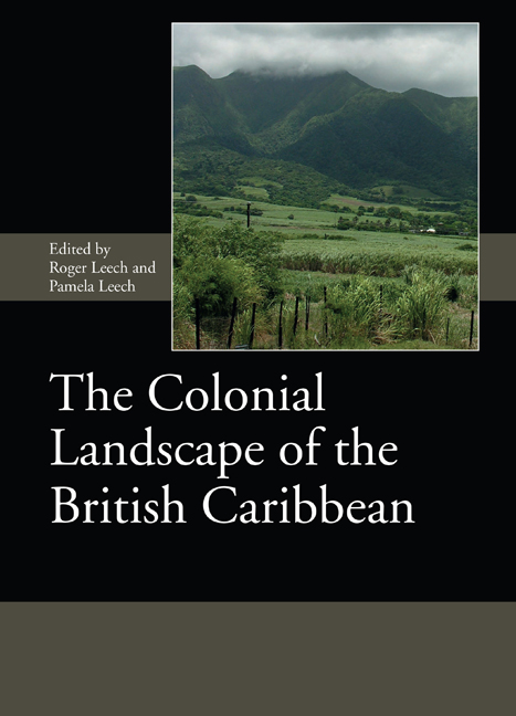
The Colonial Landscape of the British Caribbean
-
- Published by:
- Boydell & Brewer
- Published online:
- 31 March 2021
- Print publication:
- 19 March 2021
Dung on the Wall. Ontology and Relationality in Qurna: The Case of TT123
-
- Journal:
- Cambridge Archaeological Journal / Volume 31 / Issue 4 / November 2021
- Published online by Cambridge University Press:
- 23 March 2021, pp. 551-563
-
- Article
- Export citation
3 - ‘Come Hell or High Water’: Architectural Responses to Natural Disaster in the Early British Caribbean
-
-
- Book:
- The Colonial Landscape of the British Caribbean
- Published by:
- Boydell & Brewer
- Published online:
- 31 March 2021
- Print publication:
- 19 March 2021, pp 39-56
-
- Chapter
- Export citation
7 - An Archaeological Survey of Sugar Plantations in St Kitts, 2004 and 2005
-
-
- Book:
- The Colonial Landscape of the British Caribbean
- Published by:
- Boydell & Brewer
- Published online:
- 31 March 2021
- Print publication:
- 19 March 2021, pp 131-172
-
- Chapter
- Export citation
III - The Colonial Landscape of Nevis
-
- Book:
- The Colonial Landscape of the British Caribbean
- Published by:
- Boydell & Brewer
- Published online:
- 31 March 2021
- Print publication:
- 19 March 2021, pp 175-176
-
- Chapter
- Export citation
6 - Archaeological Evidence for Enslaved African Laborers from Two Locations at the Brimstone Hill Fortress, St Kitts, West Indies
-
-
- Book:
- The Colonial Landscape of the British Caribbean
- Published by:
- Boydell & Brewer
- Published online:
- 31 March 2021
- Print publication:
- 19 March 2021, pp 89-130
-
- Chapter
- Export citation
List of Contributors
-
- Book:
- The Colonial Landscape of the British Caribbean
- Published by:
- Boydell & Brewer
- Published online:
- 31 March 2021
- Print publication:
- 19 March 2021, pp xviii-xviii
-
- Chapter
- Export citation
1 - Caribbean Colonial Cartography: Exploring the Paper Landscape
-
-
- Book:
- The Colonial Landscape of the British Caribbean
- Published by:
- Boydell & Brewer
- Published online:
- 31 March 2021
- Print publication:
- 19 March 2021, pp 3-14
-
- Chapter
- Export citation
Dedication
-
- Book:
- The Colonial Landscape of the British Caribbean
- Published by:
- Boydell & Brewer
- Published online:
- 31 March 2021
- Print publication:
- 19 March 2021, pp v-vi
-
- Chapter
- Export citation
2 - Tropical Similarities Found in Military Barracks, Hospitals and Other Structures in the West Indies and British Florida Parishes
-
-
- Book:
- The Colonial Landscape of the British Caribbean
- Published by:
- Boydell & Brewer
- Published online:
- 31 March 2021
- Print publication:
- 19 March 2021, pp 15-38
-
- Chapter
- Export citation
5 - Changing Technology in the West Indian Sugar Industry, 1650–1920: A Visual Introduction
-
-
- Book:
- The Colonial Landscape of the British Caribbean
- Published by:
- Boydell & Brewer
- Published online:
- 31 March 2021
- Print publication:
- 19 March 2021, pp 73-88
-
- Chapter
- Export citation
Foreword
-
- Book:
- The Colonial Landscape of the British Caribbean
- Published by:
- Boydell & Brewer
- Published online:
- 31 March 2021
- Print publication:
- 19 March 2021, pp xix-xx
-
- Chapter
- Export citation
4 - London, Capital of Empire – Some Archaeological Reflections
-
-
- Book:
- The Colonial Landscape of the British Caribbean
- Published by:
- Boydell & Brewer
- Published online:
- 31 March 2021
- Print publication:
- 19 March 2021, pp 57-70
-
- Chapter
- Export citation
11 - A Caribbean Context for the World-System: A Case Study in 17th-and 18th-Century Economic and Social Interdependency
-
-
- Book:
- The Colonial Landscape of the British Caribbean
- Published by:
- Boydell & Brewer
- Published online:
- 31 March 2021
- Print publication:
- 19 March 2021, pp 217-232
-
- Chapter
- Export citation
