We use cookies to distinguish you from other users and to provide you with a better experience on our websites. Close this message to accept cookies or find out how to manage your cookie settings.
To save content items to your account,
please confirm that you agree to abide by our usage policies.
If this is the first time you use this feature, you will be asked to authorise Cambridge Core to connect with your account.
Find out more about saving content to .
To save content items to your Kindle, first ensure no-reply@cambridge.org
is added to your Approved Personal Document E-mail List under your Personal Document Settings
on the Manage Your Content and Devices page of your Amazon account. Then enter the ‘name’ part
of your Kindle email address below.
Find out more about saving to your Kindle.
Note you can select to save to either the @free.kindle.com or @kindle.com variations.
‘@free.kindle.com’ emails are free but can only be saved to your device when it is connected to wi-fi.
‘@kindle.com’ emails can be delivered even when you are not connected to wi-fi, but note that service fees apply.
Geophysical prospection and archaeological excavation are helping to contextualise a group of Middle Bronze Age metalwork hoards in Brittany. At Kerouarn, three hoards with a total of 89 bracelets were found buried in a semi-circular enclosure with a monumental entrance, bounded by two deep ditches and their associated embankments. No domestic or funerary remains were discovered.
Late medieval Europeans extended exploitation of fish stocks to marine frontiers previously little affected by intense human predation. Driven by demand since the twelfth century and supported by waves of innovative capture and preservation methods, herring fisheries in the North Sea and Baltic fed millions of northern Europeans with the largest medieval catches known. Stockfish (naturally freeze-dried cod) from arctic Norway went from a regional subsistence product c.1100 to an export trade profiting fishers and merchants alike. Elsewhere entrepreneurs caught, preserved, and exported pike and other fish from the eastern Baltic, hake and conger from the Channel approaches and Bay of Biscay, and migratory bluefin tuna off Sicily and the Gulf of Cadiz, all for consumption a thousand and more kilometers away. Transforming local abundances for distant tables at unprecedented scale drove new capitalized forms of organization and market behaviour. Consumers, merchants, and fishers saw fish as economic objects disconnected from any familiar nature and free for competitive exploitation. Yet besides prospects of infinite abundance the new frontier fisheries posed risks, and not simply those of hazardous access or human conflict. Heavily fished local stocks of herring successively crashed to commercial insignificance when further stressed by environmental changes in the pulsating arrival of the Little Ice Age. But the almost accidental discovery of virgin cod stocks off Newfoundland in the 1490s confirmed the mythic belief that abundance always lay over the next horizon. Thoughts of limits vanished at the eve of modernity.
This article revisits the French region of Brittany on the basis of sustained empirical research over a 25-year period. It identifies the twin use of influence and identity as forming a key part of an accepted and largely diffused territorial repertoire, based on affirming distinctiveness for reasons of vertical linkage, as well as horizontal capacity building. This article explores the different facets of this model of territorial influence. The two twin dimensions concern: first, a well-versed mechanism of lobbying central institutions and actors to defend the Breton interest; second, the use of territorial identity markers to forward the regional cause, relying on social movements and a broad capacity for regional mobilization. Within this overarching context, the Breton case demonstrates an intelligent instrumental use of identity and identity markers, but mainstream Breton forces recognize that this only makes sense in the light of the national level of regulation and structure of opportunities. The logic of this position is to integrate the Brittany region into a national model of territorial integration, while playing up identity markers to secure the maximum benefit for the region.
This chapter assesses the evidence from the medieval Celtic-speaking world for visions of heaven, hell, and the intermediary state. It begins with a critique of twentieth-century scholarship, which tended to focus its attention on the most fantastical vision texts at the expense of explicating a more representative sample of primary sources. The disparity is noted in the survival rate of texts from medieval Ireland as opposed to medieval Wales, and it is argued that medieval Welsh conceptions of the afterlife need to be pieced together from fragmentary references in religious poetry and other sources. By contrast, many extended descriptions of the afterlife survive from medieval Ireland – both freestanding vision texts and vision narratives embedded in sources of other genres. These are assessed in the context of an argument that more close readings of visions are needed before medieval Irish and Welsh geographies of the afterlife can be fully understood.
The discovery of a multi-chambered long cairn in central Brittany dating to the Middle Neolithic period challenges previous conceptions of the coastal focus of Neolithic society in this region.
Terrestrial laser scanning (TLS) provides a means of rapid and highly accurate survey of archaeological excavations and structures at landscape scales, and is particularly valuable for documenting tidal environments. Here, the authors use TLS to record tidal fixed fishing structures and a tide mill within the Léguer Estuary at Le Yaudet, in north-west France. As part of a comprehensive resource-exploitation system, the early medieval (sixth to eighth centuries AD) structures lie within, and exploit different parts of, the tidal frame. The results are used to quantify production within an estuarine landscape associated with seignorial or monastic control of environmental resources.
Carmen was produced in Ireland and Brittany in 1878 when both populations were exploring questions of identity. In Ireland, the tension between the local inhabitants and their colonial masters was giving rise to Celtic nationalism. In Brittany, while regional identity was important, so too was the connection with wider French culture.
Breton productions relied largely on local forces, (the notable exception being Célestine Galli-Marié, the original Parisian Carmen), with careful preparation, rehearsal and advanced publicity. Brittany was fortunate in having publicly subsidised theatres and municipal support for singers, orchestras and choruses which facilitated productions. In contrast, Irish theatres were privately owned, depending largely on touring companies, usually from Britain. The impresario Mapleson, manager of the Italian Opera Company, had arranged to take his production with Minnie Hauk as Carmen from London to New York, but finding that theatres were available in both Dublin and Cork, seized the opportunity to present a short season in Ireland before embarking for America.
The critical reception was mixed, with good and bad reviews after every performance. Whereas the Irish Carmen was seen to reflect the rebellious spirit of the age, Carmen in Brittany followed the redemptive route of the religious pardon of local ritual.
In the nineteenth century, two Neolithic axe-heads were reported from the Michelsberg enclosure system at Kapellenberg. The recent identification of an unusually large tumulus, from which the axe-heads were almost certainly once recovered, reveals that socio-political hierarchisation, linked to the emergence of high-ranking elites in Brittany and the Paris Basin during the fifth millennium cal BC, may have extended into Central Europe.
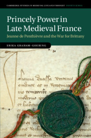
Jeanne de Penthièvre (c.1326–1384), duchess of Brittany, was an active and determined ruler who maintained her claim to the duchy throughout a war of succession and even after her eventual defeat. This in-depth study examines Jeanne's administrative and legal records to explore her co-rule with her husband, the social implications of ducal authority, and her strategies of legitimization in the face of conflict. While studies of medieval political authority often privilege royal, male, and exclusive models of power, Erika Graham-Goering reveals how there were multiple coexisting standards of princely action, and it was the navigation of these expectations that was more important to the successful exercise of power than adhering to any single approach. Cutting across categories of hierarchy, gender, and collaborative rule, this perspective sheds light on women's rulership as a crucial component in the power structures of the early Hundred Years' War, and demonstrates that lordship retained salience as a political category even in a period of growing monarchical authority.
The Brittany region of France is located in a low seismicity intraplate zone. Most of the instrumented earthquakes are limited to a shallow crustal depth without surface rupture. A paleoseismological analysis was performed on deposits on the Crozon Peninsula and in the Elorn estuary. We highlight hydroplastic deformations induced by liquefaction leading to clay diapirism, which were likely triggered by past earthquakes. This diapirism seems to be frequent in continental nonconsolidated sediments and to develop on the inherited tectonic structures, when a shallow water table and confining layers exist. Timing of deformation is dated using paleoenvironmental data, and electron spin resonance and infrared-stimulated luminescence dating methods. Two seismic periods were identified in western Europe during early Marine Oxygen Isotope Stage (MIS) 10 (~380 ka) and early MIS 8 (~280–265 ka). The lack of similar deformations affecting the Holocene tidal deposits in the Bay of Brest suggests that the magnitude of the triggering paleoearthquakes is probably higher (Mw ~6) than the recent events (Mw 5.4). These unusual intraplate major paleoearthquakes need specific factors affecting the far-field crustal stress loading to be triggered, such as a brief acceleration of the Africa-Eurasia lithospheric plate convergence, glacio-isostatic stress perturbations associated with the onset of major glaciations in northern Europe, or other processes induced by orbital forcing.
Deerite has been found in layers of Fe-rich metasediments, metamorphosed under conditions of blueschist to eclogite facies (T = ca. 480°C). Geochemical comparisons with other deerites described in the literature show that the Ile de Groix deerites most closely resemble the Mn-poor, alpine type, and Sifnos deerites. The P-T conditions of the Ile de Groix metamorphism do not conform with the stability field of deerite. In the assemblages examined here deerite seems to be a relic from earlier stages of prograde metamorphism.
This article presents a comparative study of the arrowheads found in graves dating to between 2500 BC and 1700 bc in north-west France, southern Britain and Denmark. The aim is to characterise their modes of production and functions during a period which successively sees the introduction of copper then bronze metallurgy, the former accompanying the appearance of Bell Beaker pottery and associated practices in these areas. Several modes of production are proposed, from individual manufacture by Bell Beaker-using warriors to specialist production for elite use during the Early Bronze Age. Over and above their function as weapons – arguably associated more with interpersonal combat than with hunting – arrowheads served to portray and emphasise the social status of the individuals. In the case of the Early Bronze Age Armorican arrowheads, they should be regarded as ‘sacred’ objects, made for display and enhancing the power of the chiefs. Lastly, arrows are placed in the broader perspective of major trends affecting Europe during the Bell Beaker period and then the Early Bronze Age, while the distribution of arrowheads with slanted barbs suggests the operation of an Atlantic cultural complex.
Coastal distributions such as that of the Neolithic chambered tombs of Brittany raise important questions about prehistoric beliefs and understandings relating to sea and shoreline. Concepts of liminality come particularly to the fore where headlands and islands are selected as places for the disposal of human remains. The density of chambered tombs recorded by Du Châtellier on the islands of the Molène archipelago, with its rocks, inlets and small islands exposed and covered by the tides, provides a prominent example of this coastal emphasis. The analysis presented here includes assessment of the reliability of the Du Châtellier inventory and of the topographic changes resulting from sea-level rise. It is argued that the dramatic transformative effect of the tides on the shallow waters of this archipelago will have enhanced the liminality of the setting and may have endowed the islands with special mythological or symbolic associations that may explain the density of the monuments. Ethnographic accounts of coastal beliefs from North America and northern Europe provide additional indications of the likely symbolic importance of such shoreline settings for Breton Neolithic communities.
The cirratulid species Chaetozone corona is reported for the first time from the North-east Atlantic waters. Several specimens were collected during oceanographic surveys between 1996 and 2015 from soft bottom habitats along the coasts of Brittany (Western France). This species, originally described from the coast of California, was recently recorded for the first time from the Mediterranean Sea. We hypothesize that this species could have been recently introduced to the Atlantic coasts of Europe and colonized the northern coast of Bay of Biscay from the Loire estuary to the Iroise Sea. We discuss the potential vectors of introduction and the main environmental factors that could explain its current distribution. An identification key to all the known North-east Atlantic species of Chaetozone is given.
In the Bay of Douarnenez, in a reference area surveyed for echinoderms, the relative abundance of epifaunal ophiuroids (Ophiothrix fragilis and Ophiocomina nigra) was estimated by dredging and video surveys. Two surveys were undertaken in 2008 and 2011, following a protocol similar to that used in a long-term survey conducted in the 1980s. The data were then compared between the two periods. The present observations demonstrate a recolonization of this site by these ophiuroids, which had almost disappeared between 1983 and 1988. However, although the mean densities of Ophiothrix fragilis were similar to those found prior to this general ophiuroid decrease, Ophiocomina nigra densities were much greater. This latter species not only increased significantly in density and bottom coverage in the reference area, but also showed strong juvenile recruitments on maerl beds and colonization of other bottoms of the bay at very high densities according to a geostatistical analysis. Further studies would be necessary to establish whether or not there is a cause-and-effect relationship between the increase of green algae in the bay and the development of this opportunistic species.
The furnished barrow burials of Wessex represent a maturation of the Beaker rite during the Early Bronze Age in Britain. Many of these burials were unearthed centuries ago, when archaeology was at its most eager and insouciant, but – happily for us – there were often a few careful recorders on hand. Thanks to their records, the modern scientists engaged in the Beaker People Project can still follow the trail back to a museum specimen and obtain high precision dates – as in the case of the ‘Wessex 1’ grave from West Overton in Wessex reported here.
Refitting flakes to cores is a well-developed way to investigate how stone tools were made. Here the author takes on the formidable task of refitting the stone blocks of menhirs, orthostats and megalithic tombs to their quarries. The results are impressive: the order of erection in a row of menhirs, the method of construction in a passage grave and the monumental chronology of a region are just three of the rewards of this promising new method.
Ireland, Scotland, the Isle of Man, Wales, south-western Britain (Cornwall and Devon) and Brittany were the principal Celtic countries in the sixth and seventh centuries, although some other parts of Western Europe still had a Celtic vernacular language at that time. Brittany, south-western England and Wales had all been part of the Roman Empire, though the level of participation in Roman material culture and civic life varied enormously across them and though some parts had frequently had a military presence. Eastern Brittany and south-east Wales had been more affected, and the coasts of Wales, had had forts built and refurbished in the late fourth century. Despite the geographical differences, the economic base in Celtic areas was one of mixed farming, supplemented by hunting and gathering when appropriate. The structure of Celtic societies in the sixth and seventh centuries is also complicated by the migration factor and its uneven operation, as are societies in so many other parts of Western Europe.