To save content items to your account,
please confirm that you agree to abide by our usage policies.
If this is the first time you use this feature, you will be asked to authorise Cambridge Core to connect with your account.
Find out more about saving content to .
To save content items to your Kindle, first ensure no-reply@cambridge.org
is added to your Approved Personal Document E-mail List under your Personal Document Settings
on the Manage Your Content and Devices page of your Amazon account. Then enter the ‘name’ part
of your Kindle email address below.
Find out more about saving to your Kindle.
Note you can select to save to either the @free.kindle.com or @kindle.com variations.
‘@free.kindle.com’ emails are free but can only be saved to your device when it is connected to wi-fi.
‘@kindle.com’ emails can be delivered even when you are not connected to wi-fi, but note that service fees apply.
Terrain-aided navigation with a three-dimensional (3D) map has both high accuracy and high reliability, which is crucial for applications in the global navigation satellite system (GNSS)-denied scenarios. In this paper, a new terrain matching algorithm with 3D Zernike moments (3D ZMs) is proposed. The redundant items in the even-order 3D ZMs are analysed in theory. The 3D ZMs are also correlated with the standard deviations of terrain further to identify the redundant items. The new 3D ZM descriptors are proposed for the feature vector of the matching algorithm by excluding the redundant items from the descriptors. The simulation results demonstrate that the algorithm with the revised descriptors achieves a higher matching success rate than both that with the existing descriptors and that with the odd-order descriptors under the same conditions.
This paper studies the probability of active navigational error events for use in ship–bridge allision risk analysis. To estimate the probability of these kinds of events, accident databases, incident reports and AIS data were studied; the case studies herein cover 6 years and 15 bridges in Scandinavia. The main findings of this paper show that there is great variation in the probability of ship–bridge allision due to active navigational errors, and it is not recommended to use the currently common practice of 2% uniform distribution of the number of ship passages on all bridges. Another important finding is that the probability of a ship striking a bridge due to the error type Wrong Course at a Turning point is not uniform along the length of the bridge, but is only likely to occur in a cone formation from the last turning point.
This article deals with Hecataeus of Miletus fr. 310 Jacoby, featuring a curious list of islands located along the Nile, and bearing Greek names such as Ephesus, Chios, Lesbos, Kypros and Samos. Scholars generally assume the list, composed in the late sixth or early fifth century, represents joint Greek emporia established on Egyptian soil, thereby serving as a reliable testimony to the emergence of collective Greek identities during the late Archaic period. The composition of the list, along with the contemporary historical, cultural and archaeological contexts of its place names, is examined with particular emphasis on the collective identities of the islanders. On this basis, it is contended that the list lacks any evidence pertaining to Greek commercial footholds or collective identities in Egypt. Rather, fr. 310 serves as a practical navigational mnemonic, delineating culturally familiar geographical landmarks to assist Greek sailors in traversing a complex foreign river passage. The fragment now emerges as a valuable historical document, illuminating Greek navigational knowledge and practices during the late Archaic period.
The Plane or Plain Scale is a navigational device that dates back to the early 1600s but has long since ceased to be used in practice. It could perform the function of a protractor and be used to solve problems in plane trigonometry. In addition, coupled with a suite of remarkable geometric constructions based on stereographic projection, the Plane Scale could efficiently solve problems in spherical trigonometry and hence navigation on a sphere. The methods used seem today to be largely unknown. This paper describes the Plane Scale and how it was used.
The path navigation of robot in an entirely known space is presented by various researchers in the recent times. The navigational complexity arises when a robot moves in a completely unknown and complex environment from one defined start to a designated desired location. As the success of the nature-inspired algorithms in the unclear navigational problem is better, therefore, an improved butterfly optimization algorithm (IBOA) to determine the optimal feasible path for a humanoid robot navigating through a platform cluttered with both known and unfamiliar barriers is presented in this study. The BOA is inspired by the food-gathering habits of butterflies, where the sense of smell is the vital parameter in the global optimal search. However, the performance of this technique in the complex environment is poor, as a result, the chances of being trapped in local minima are more. Hence, the BOA is improved by using a nonlinear weight reduction strategy in updating the position of the butterflies in every iteration. The simulation is carried out in the Webots platform by considering variable-legged robot, NAO, in an unfamiliar environment. The outcomes derived from the simulation and real assessments demonstrate the potential of the proposed technique and compare with other existing algorithms, which highlights the potential and efficacy of the proposed IBOA algorithm.
Among maritime accidents, fishing vessel collisions are particularly prone to both high frequency and severity. This study aims to identify the correlation between effective collision speed (Delta-V) and the severity of hull damage in fishing vessel collisions. Using data from collisions in South Korea, the study examines the influence of collision-related factors including Delta-V, collision location, collision subject, collision angle and the hull material of the impacted vessel on the extent of vessel damage. Statistical analyses and binary logistic regression were employed to assess trends and relationships between these variables. The findings confirm direct associations between hull damage severity and factors such as tonnage, collision location, the striking vessel and the extent of hull damage.
In this period, states strove for more control over their international trade routes. However, this was a matter of ideology and planning rather than a reality. Trades were still mainly supervised by chartered companies. States increasingly aimed to restrict exports of their colonial goods to other countries. However, their ‘mercantilist’ approaches did not yield the results that were expected. In attempts to reduce smuggling, private trade became acknowledged more. An aim of consolidating and perfecting colonial trade had more impact in Asia than in the Caribbean. There, geopolitical contexts as well as features of crops precluded strict control. Compared to the previous period, international trade law consisted mostly of treaty law. Some clauses, such as the most-favoured-nation clause, could be opted for in many treaties. Legal borrowing happened, for example, with regard to governance structures in colonial territories, but there was no harmonised law of international trade. Domestic legislation was combined with treaties. Ius gentium doctrine mainly focused on a right of trade. In the later eighteenth century, views of this type were combined with ideas of self-reliance of the economy. Over the course of the seventeenth and eighteenth centuries, financial markets had become a factor that policy-makers had to take into account. Because of the growing intertwining of state finance, colonial trade and speculation at stock markets, the risk of bubbles rose.
In the period of the Renaissance, trade became a matter of legislation and policy. Municipal governments and princes aimed to facilitate trade. International trade relations became increasingly supervised by states. This came in tandem with more treaties. From the middle of the fifteenth century onwards, specialized institutions were created and they increased control over foreign merchants. As a result of growing government intervention, the rules relating to trade were found in bylaws, charters and statutes. Besides those there were customs of trade, which were mostly local. New mercantile techniques, becoming widespread in this period, were maritime insurance, bills of exchange and partnerships of merchants. Insolvency became regulated in the sixteenth century. From the 1500s onwards, rights of hospitality for traders and a right of trade were developed in ius gentium writings. However, due to the mostly local customs and legislation, trade across European countries was far from harmonised. Gerald Malynes proposed a universal custom of trade, but he struggled with the combination of ius gentium ideas with the more factual customs of trade. His views nonetheless laid the basis for later categorisations of commercial law as being customary and transnational.
The Element considers historiography – the extent to which insular prehistorians have integrated their findings with the archaeology of mainland Europe; and the ways in which Continental scholars have drawn on British material. An important theme is the cultural and political relationship between this island and the mainland. The other component is an up-to-date account of prehistoric Britain and her neighbours from the Mesolithic period to the Iron Age, organised around the seaways that connected these regions. It emphasises the links between separate parts of this island and different parts of the Continent. It considers the links across the Irish Sea as only one manifestation of a wider process and treats Ireland on the same terms as other accessible regions, from France to the Low Countries. It shows how different parts of Britain were separate from one another and how they can be studied in a European framework.
This chapter covers the two decades from the first minuted meeting of the Commissioners of Longitude in 1737. During this time, small groups of Commissioners were called together sporadically for ad hoc meetings, principally to agree funding for specific projectors, notably clockmaker John Harrison and longitude veteran William Whiston. Over this initial period, relations with Harrison were cordial and supportive. Despite these promising developments, it was a period in which public opinion gradually reverted to mockery of those seeking the seemingly impossible longitude dream. The chapter seeks to emphasise in addition the value of looking at some of the schemes that more recent authors have dismissed as invalid. This has occurred not only when proposals seem unlikely to modern eyes but also when their authors were partly or wholly motivated by factors such as religion or financial need, and overlooks the reception of those proposals. The books published by Jane Squire are a particular focus, since they contain some of the best records of the Commissioners’ activities and thoughts during the earlier decades.
This chapter details the creation and management of the Nautical Almanac, one of the Board of Longitude’s most important concerns. Appointed Astronomer Royal and thus a Commissioner of Longitude in 1765, Nevil Maskelyne oversaw its publication and that of associated texts, directing the work of a group of mathematical computers overseen by comparers. Hierarchical organisation and increasing costs preoccupied much of the Board of Longitude’s subsequent affairs. Calculated up to a decade in advance, the Nautical Almanac became a symbol of the Board’s repute among foreign academies and observatories, although its accuracy was later subject to satire and criticism. After Maskelyne’s death, work seems to have suffered and its management was overhauled by the Longitude Act of 1818 that brought it under Thomas Young’s management. Controversy wracked the Board’s direction of the Nautical Almanac for the next decade. Its assignment from 1831 to the astronomer William Stratford as superintendent was a major element of the aftermath of the Board’s abolition.
This chapter offers a survey of the ways in which the British Board of Longitude handled the range of schemes and projects that were presented by mathematicians and mariners, inventors and entrepreneurs during its final decades to 1828. Labels of impracticality, eccentricity and derangement have long been assigned to many of these proposals, notably in the classification scheme imposed by Astronomer Royal George Airy in his reorganisation of the Board’s archives from the 1840s. This chapter favours close reading of the ways in which schemes were assessed and managed at the time. In the bulky correspondence received, schemes for new devices, calculation methods or navigation techniques were mixed with projects for squaring the circle or endless mechanical power. The Board distinguished between those projects reckoned impossible or unsound, and those it judged irrelevant or beyond its scope. It is shown how much discretionary power the Board exercised, and how its accumulated papers preserve a wide range of protagonists’ technical and scientific interests.
This chapter scrutinises the British Longitude Act of 1714 and its immediate aftermath. It shows, first, the extent to which the wording of the Act drew on precedents from the previous century. Second, it argues that the Act was never intended to create a ‘Board of Longitude’ as a formal, standing committee with regular meetings. Rather, it nominated a number of individuals – by name or by virtue of their official role – seen fit to judge potential ideas. This is a powerful example of the way in which longitude legislation was revisable and open-ended. With this in mind, the chapter shows that the Act did indeed foster considerable activity and discussion around longitude matters over the next two decades. This activity was marked by considerable continuity in the persistence of schemes already being discussed before 1714: eclipses, lunar distances, artificial timekeepers, magnetic variation and dip, signalling, and dead reckoning.
Focusing on the period from the early 1760s to the resolution of the John Harrison affair in 1773, this chapter argues that it was only in this period that the ‘Board of Longitude’ came into being. This was largely in response to the debates surrounding the sea trials of Harrison’s fourth marine timekeeper (H4) and two other longitude schemes – Tobias Mayer’s tables and method for lunar distances and Christopher Irwin’s marine chair for observing Jupiter’s satellites. The transformation into a standing board manifested in regular rather than sporadic meetings and the appointment of a secretary to keep the Board’s papers in order as the Commissioners, for whom astronomer Nevil Maskelyne would become a central figure, sought to defend their decisions over the allocation of monetary rewards. The debates with Harrison, which focused on questions of adequate testing and the judging of trials, disclosure and replicability, and accusations of self-interest, would see the Board harden its stance through the use of legislation to ensure resolution. The Harrisons and their supporters, by contrast, sought to bolster support through lobbying and publication of their claims.
This chapter explores the long- and short-term roots of the British Longitude Act 1714, highlighting the degree of continuity with earlier precedents. It first explores the nature and impact of developments in navigational techniques and instruments, astronomy, timekeeping, the finding of longitude on land and the judging and funding of longitude proposals in sixteenth- and seventeenth-century Europe. It then delves into the chain of events and written and verbal discussions which gave rise to the new British rewards in 1713–1714. These saw the self-interested lobbying of two projectors gain momentum through a confluence of national and political interests, before becoming enshrined in law as rewards open to all comers.
In the early modern period, the waters of East and Southeast Asia saw a bustling maritime trade. To conduct this trade, ships needed competent sailors to safely travel between ports. Chinese sources name one person as particularly important: the huozhang 火長. The sources tell us that the huozhang were charged to use the compass and, employing sailing manuals, to guide ships in the correct direction. In this role, they had to work closely with other sailors, such as duogong 舵工 (steersmen). This article reconstructs the role and function of the navigating personnel on Chinese ships, as well as the tools they used to determine course in the period between the fifteenth and eighteenth century.
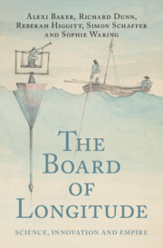
In the first book-length history of the Board of Longitude, a distinguished team of historians of science bring to life one of Georgian Britain's most important scientific institutions. Having developed in the eighteenth century following legislation offering rewards for methods to determine longitude at sea, the Board came to support the work of navigators, instrument makers, clockmakers and surveyors, and assembled the Nautical Almanac. Utilizing the archives and records of the Board, recently digitised by the same team, the authors shed new light on the Board's involvement in colonial projects, Pacific and Arctic exploration, as well as on innovative practitioners whose work would otherwise be lost to history. This is an invaluable guide to science, state and society in Georgian Britain, a period of dramatic industrial and imperial and technological expansion.
This paper proposes a mobile robot recovery mechanism for low-cost robotic systems due to vision sensor failure in vSLAM systems. The approach takes advantage of ROS architecture and adopts the Shannon Nyquist sampling theory to selectively sample path parameters that will be used for back travel in case of vision sensor failure. As opposed to point clouds normally used to store vSLAM data, this paper proposes to store and use lightweight variables namely distance between sampled points, velocity combinations, i.e., linear and angular velocity, sampled period, and yaw angle values to describe the robot path and reduce the memory space required to store these variables. In this study, low-cost robotic systems typically using cameras aided by proprioceptive sensors such as IMU during vSLAM activities are investigated. A demonstration is made on how the ROS architecture can be used in a scenario where vision sensing is adversely affected, resulting in mapping failure. Additionally, a recommendation is made for adoption of the approach for vSLAM platforms implemented on both ROS1 and ROS2. Furthermore, a proposal is made to add an additional layer to vSLAM systems that will be exclusively used for back travel in case of vision loss during vSLAM activities resulting in mapping failure.
Identified by Immanuel Wallerstein as the first true hegemon, the Dutch Empire dominated maritime commerce in the seventeenth century. Amsterdam emerged as the world’s alpha city, the site of the first true global multinational corporations. In tandem with corporate activities including the founding of New York City, Cape Town, and Jakarta, Amsterdam established the first modern stock market. It also solidified the North–South power imbalance. European powers extracted the labor and raw materials of far-flung colonies, refining them at higher value. The under-populated Dutch Empire relied on forced migration and slave labor to produce valuable goods such as sugar, tobacco, and spices. This chapter traces the emergence of a city network in the Low Countries that prefigured its independence from Spain, and the construction of its own imperial network. The Dutch city network expanded globally, establishing critical nodes in West Africa, the Americas, the Caribbean, and Asia to manage the flow of resources and labor. Amsterdam’s place at the top of the world city hierarchy led to rising inequality, prefiguring modern urban “command centers.”
As Stephen Dedalus walks upon Sandymount Strand in Ulysses, he thinks, “the land a maze of dark cunning nets … Ringsend: wigwams of brown steersman and master mariners. Human shells” (3.154–57). This thought evokes Ireland’s complicated position as an island nation and its entanglements with fellow colonized peoples. For Ireland’s cultural mariners of the twentieth century, navigating such currents requires a knowledge not only of sea but also of sky. In the “Wandering Rocks” episode of Ulysses, a chapter where the city of Dublin is the prominent star, the sections are separated by a series of three asterisks also known as a dinkus. As a writer for the Paris Review explains, a dinkus is “used as a section break in a text. It’s the flatlining of an asterism (⁂), which in literature is a pyramid of three asterisks and in astronomy is a cluster of stars.” Asterisms serve as a striking intervention into the textual groundswells of Joyce’s Ulysses that ultimately connect to Derek Walcott’s own navigations in Omeros as a means of paternal inheritance and transatlantic affiliation.