To save content items to your account,
please confirm that you agree to abide by our usage policies.
If this is the first time you use this feature, you will be asked to authorise Cambridge Core to connect with your account.
Find out more about saving content to .
To save content items to your Kindle, first ensure no-reply@cambridge.org
is added to your Approved Personal Document E-mail List under your Personal Document Settings
on the Manage Your Content and Devices page of your Amazon account. Then enter the ‘name’ part
of your Kindle email address below.
Find out more about saving to your Kindle.
Note you can select to save to either the @free.kindle.com or @kindle.com variations.
‘@free.kindle.com’ emails are free but can only be saved to your device when it is connected to wi-fi.
‘@kindle.com’ emails can be delivered even when you are not connected to wi-fi, but note that service fees apply.
Excavations at the Infantas complex in Chillón Valley, Perú, revealed a U-shaped monumental centre with a central mound, clay staircase and columned atrium. Aligned with structures from the Rímac and Lurín valleys, these complexes anchored ritual-political power, serving as hubs for ideological integration and territorial organisation in early Andean societies.
Este texto tiene un carácter exploratorio a partir de la experiencia etnográfica del levantamiento indígena y popular que paralizó Ecuador en el mes de junio de 2022. Con epicentro en Quito, la capital del país, dicha movilización fue la más larga de todas las que ha protagonizado el movimiento indígena ecuatoriano desde la década de 1990. El artículo reflexiona sobre las características de esta última protesta; señala sus diferencias con respecto a las movilizaciones de los años noventa y de los primeros años de este siglo XXI; y plantea algunas hipótesis sobre la nueva generación de líderes que están al frente de la organización indígena más importante del país, la CONAIE (Confederación de Nacionalidades Indígenas del Ecuador). El argumento principal que se explora es que la adopción de discursos y repertorios de protesta más orientados hacia una dimensión clasista que hacia una puramente etnoidentitaria ha sido la clave en la mayor capacidad de convocatoria del movimiento. Esto se reflejó en el masivo respaldo al llamado de la CONAIE contra las medidas neoliberales adoptadas por el Gobierno nacional.
The nature and extent of the Tiwanaku state expansion in the Andes during the second half of the first millennium AD continues to be debated. Here, the authors report on the recent discovery of an archaeological complex 215km south-east of Tiwanaku, where a large, modular building with an integrated, sunken courtyard strongly resembles a Tiwanaku terraced platform temple and demonstrates substantial state investment. Constructed, the authors argue, to directly control inter-regional traffic and trade between the highlands and the eastern valleys of Cochabamba, the complex represents a gateway node that effectively materialised the power and influence of the Tiwanaku state.
Monumental constructions are often associated with developed power structures, exploiting unequal access to resources to control large labour forces. Yet archaeological research worldwide increasingly shows that this model is not only an oversimplification, but often is also wrong. Here, the authors explore the burial mounds at Kaillachuro in the Peruvian Andes, and present new radiocarbon dates that position these mounds as the earliest evidence of monumental architecture in the Titicaca Basin. Built over 2000 years through recurring acts of communal memorialisation, this novel architectural tradition forces us to reflect on the role of ritual in socioeconomic transformations of highland Andes communities.
The sacralisation of mountains played an important role in the expansion of the Inca Empire into the south-central Andes during the mid-second millennium AD. Here, the authors compare archaeological material from sacralised mountains in north-western Argentina, highlighting not just the shared attributes of high-altitude sites but also the diversity of ways in which Inca dominion over the mountains could be materialised. Focusing on Mount Inca Viejo, in the Argentine province of Salta, the authors further explore the characterisation of sacred mountains and the significance of mining and mineral acquisition as a motivator for Inca expansion.
Two new species, Placomaronea fruticosa and P. placoidea, are described. They were originally discovered in the southern Peruvian Andes at altitudes between 3000 and 4650 m. One specimen of P. fruticosa was subsequently also found among herbarium material collected in Argentina. Placomaronea fruticosa is terricolous in high altitude grasslands with rocky cliffs. It is characterized by its fruticose to subfruticose thallus, which is up to 8 mm tall and partially immersed in the substrate, its branches are bright to deep yellow, flattened and on the substrate surface their elongated apices resemble placodioid lobes of crustose species in the genus Candelina, whereas the cylindrical basal parts are pale beige to deep violet and mostly grow immersed in their substrate. The species has asci with over 20 ascospores in a 60–80 μm tall hymenium. Placomaronea placoidea is a saxicolous species, growing in rocky exposed areas. It is characterized by its tightly adnate, foliose, placodioid thallus with a bright to deep yellow upper surface. No fertile specimens were found. Both species newly described here are morphologically very similar to species of Candelina but are clearly distinguished by a cortex anatomy characteristic of Placomaronea. Cortex anatomy can thus be immensely useful to distinguish crustose and subfoliose genera in Candelariaceae, whereas secondary chemistry is shown to be quite uniform, with some chemotype variation of little taxonomic relevance. An updated ITS-only phylogeny of Candelariaceae is presented and compared with earlier phylogenies of the family. Several well-supported clades are identified, including Candelina, Placomaronea and Protocandelariella, but much of Candelaria and Candelariella s. lat. remain unresolved, and the relationships between the supported clades are not yet known. The limitations of currently available molecular data, primarily only ITS, are discussed, particularly in relation to the lack of support at species level, such as the two newly described species of Placomaronea. An updated key to currently accepted genera in Candelariaceae and all species of Placomaronea now known is provided.
The capacocha was one of the most important types of Inca sacrifices. Road stations (tambos) were built for the pilgrims who travelled to mountain peaks with the sacrifices. Spatial analysis of two tambos on the slopes of the Pichu Pichu and Chachani volcanoes in Peru reveals segregation in the sacred landscape.
This chapter explores how taxes shape the meaning of other payments and money flows in highland Bolivia. The concept ‘ecology of payments’ is introduced to describe the world of payments amongst the so-called informally employed in the city of Cochabamba. It explores how, for instance, receipts for commercial licence taxes and property taxes paid provide people with the right to make other kinds of payments, such as fees to local neighbourhood associations and unions. An ‘ecology of payments’ pays attention to the multiple links and dependencies between payments and the way they transform each other. This approach encourages a focus on the local impact of taxes paid, as opposed to the effect of taxes on long-term state–society relations. To ascertain the role of taxes within this ecology, the chapter also aims to understand how the concept of formality informs the power and character of different payments.
Chapter three is dedicated to the tradition of the apotheosis in the Andes. It opens with the context of the Inca Empire and the civil war between Atahualpa and Huascar, and a summary of Spanish penetration from 1532. There follows a fictive reconstruction of dialogue between the Inca ruler Atahualpa and his counsellors. The chapter then analyzes the Andean identification of the Spaniards with the god Viracocha, and considers evidence that there are no references at all to the Spaniards as gods, or as associated with Viracocha, from the period of first contact with Andean peoples. There follows discussion of misunderstanding about Viracocha as a creator god. The chapter moves on to analyze two key concepts of Andean thought, camac (“life force”), and huaca/wak’a (“being with transcendent power”) and explores how Andeans used the history of huacas to interpret the Spanish invasion. To call the Spaniards Viracochas did not mean that they were gods in the European sense; rather, it was a way of linking them to the Andean past and the Andean worldview.
At Ollantaytambo, in the Cusco region of Peru, the Inka (c. AD 1400–1532) built an elaborate anthropogenic landscape to facilitate intensive agriculture. After the 1532 Spanish invasion of the region, this landscape was reshaped by the introduction of new plants and animals, colonial land-management practices and demographic transformations. Here, the author employs botanical data from a derelict Inka-era reservoir to evaluate the timing and character of colonial transformations to the local agroecology. These transformations, they argue, tended towards agricultural deintensification, but this process did not begin until decades after the Spanish invasion.
There are six species of flamingos in the world, all under pressure from human activities in their wetland habitats. Obtaining global population estimates for flamingos is challenging because of their broad geographical range, nomadic movements, capacity for long-distance flight, and the complexity of international monitoring. Two species, the Andean Flamingo Phoenicoparrus andinus and Puna Flamingo P. jamesi, during key parts of their life cycle, use wetlands in the Andes of South America, where they coexist at various sites. We compiled historical information on population estimates and ecology for these two species and integrated data collected on regional simultaneous censuses to describe population trends, current and emerging threats, and provide recommendations for conservation action. Long-term population trends have been difficult to establish given the unreliability of population estimates prior to the late 1990s. Systematic, regional censuses carried out regularly since 1997 have produced robust population estimates for the Andean and Puna flamingos (most recently, 78,000 and 154,000, respectively) and show populations of both species to be stable and increasing. Increasingly rapid changes in wetlands caused by human activities such as industrial-scale mining in breeding and foraging sites in the high Andes wetlands, and agro-industrial activities in their lowland wintering sites, focused on areas of the highest concentrations of flamingos pose threats to their survival and ability to reproduce. In addition, climate change is projected to reduce wetland habitats and some localised effects have already been detected. Continued research on the ecological drivers of flamingo abundance, movements, and population genetics to understand population structure and dynamics are necessary, as well as the identification of response variables to changing environmental conditions. Interdisciplinary and systems-level approaches in the context of international collaboration in monitoring and conservation planning among a diversity of stakeholders will be required to safeguard flamingo populations and wetland habitats.
This Andean coast research has identified 113-plus geoglyphs spanning the Formative (1800–100 BC) to the Inka period (AD 1470–1532). The project combined digital technology and Remotely Piloted Airborne Systems to locate the sites. The authors also documented examples of ceramics and intricate road systems and suggest that the finds represent meticulously ritualised landscapes.
The Redes Andinas (Andean Networks) project assesses the complexity of ancient road networks in the archaeological record in the Andes, beyond the Inca roads system. A multiscale methodological approach allows us to characterise the transformation and resilience of the road networks over the past millennium, in the context of the 18°South parallel's vertical transect.
In “How Can Spin, Ply, and Knot Direction Contribute to Understanding the Quipu Code?” (2005), mathematician Marcia Ascher referenced new data on 59 Andean khipus to assess the significance of their variable twists and knots. However, this aggregative, comparative impulse arose late in Ascher's khipu research; the mathematical relations she had identified among 200+ previously cataloged khipus were specified only at the level of individual specimens. This article pursues a new scale of analysis, generalizing the “Ascher relations” to recognize meaningful patterns in a 650-khipu corpus, the largest yet subjected to computational study. We find that Ascher formulae characterize at least 74% of khipus, which exhibit meaningful arrangements of internal sums. Top cords are shown to register a minority of sum relationships and are newly identified as markers of low-level, “working” khipus. We reunite two fragments of a broken khipu using arithmetic properties discovered between the strings. Finally, this analysis suggests a new khipu convention—the use of white pendant cords as boundary markers for clusters of sum cords. In their synthesis, exhaustive search, confirmatory study, mathematical rejoining, and hypothesis generation emerge as distinct contributions to khipu description, typology, and decipherment.
This report examines the deposit of a sixteenth-century cache of silver aquillas within a Chachapoya household at the site of Purun Llacta de Soloco. The report examines their context and contents. These findings have implications for a larger examination of social value in Andean societies and the specialized treatment and use of ritual objects during the tumultuous colonial period.
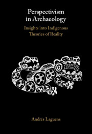
Perspectivism in Archaeology explores recurring features in Amerindian mythology and cosmology in the past, as well as distinctions and similarities between humans, non-humans and material culture. It offers a range of possibilities for the reconstruction of ancient ontological approaches, as well as new ways of thinking in archaeology, notably how ancient ontological approaches can be reconciled with current archaeological theories. In this volume, Andrés Laguens contributes a new set of approaches that incorporate Indigenous theories of reality into an understanding of the South American archaeological record. He analyses perspectivism as a step-by-step theory with clear explanations and examples and shows how it can be implemented in archaeological research and merged with ontological approaches. Exploring the foundations of Amerindian perspectivism and its theoretical and methodological possibilities, he also demonstrates applications of its precepts through case studies of ancient societies of the Andes and Patagonia.
Imagery-based survey is capable of producing archaeological datasets that complement those collected through field-based survey methods, widening the scope of analysis beyond regions. The Geospatial Platform for Andean Culture, History and Archaeology (GeoPACHA) enables systematic registry of imagery survey data through a ‘federated’ approach. Using GeoPACHA, teams pursue problem-specific research questions through a common data schema and interface that allows for inter-project comparisons, analyses and syntheses. The authors present an overview of the platform's rationale and functionality, as well as a summary of results from the first survey campaign, which was carried out by six projects distributed across the central Andes, five of which are represented here.
Recent archaeological research in the Andes suggests that Indigenous herders carefully managed their environments through the modification of local hydrology and vegetation. However, the limited geographical scale of previous research makes it challenging to assess the range and prevalence of pastoralist land management in the Andes. In this article, the authors utilise large-scale, systematic imagery survey to examine the distribution and environmental contexts of corrals and pastoralist settlements in Huancavelica, Peru. Results indicate that corrals and pastoralist settlements cluster around colonial and present-day settlements and that a statistically significant relationship exists between pastoral infrastructure and perennial vegetation. This highlights the utility of remote survey for the identification of trans-regional patterns in herder-environment relationships that are otherwise difficult to detect.
Archaeological surveys conducted through the inspection of high-resolution satellite imagery promise to transform how archaeologists conduct large-scale regional and supra-regional research. However, conducting manual surveys of satellite imagery is labour- and time-intensive, and low target prevalence substantially increases the likelihood of miss-errors (false negatives). In this article, the authors compare the results of an imagery survey conducted using artificial intelligence computer vision techniques (Convolutional Neural Networks) to a survey conducted manually by a team of experts through the Geo-PACHA platform (for further details of the project, see Wernke et al. 2023). Results suggest that future surveys may benefit from a hybrid approach—combining manual and automated methods—to conduct an AI-assisted survey and improve data completeness and robustness.
In the Andean highlands, hilltop fortifications known as pukaras are common. Dating predominantly to the Late Intermediate Period (AD 1000–1450), pukaras are important to archaeological characterisations of a political landscape shaped by conflict but the distribution of these key sites is not well understood. Here, the authors employ systematic satellite imagery survey to provide a contiguous picture of pukara distribution on an inter-regional scale covering 151 103km2 in the south-central highlands of Peru. They highlight the effectiveness of such survey at identifying pukaras and capturing regional variability in size and residential occupation, and the results demonstrate that satellite surveys of high-visibility sites can tackle research questions at larger scales of analysis than have previously been possible.